Hurricane Hilary Threatens Southern California with Record-Breaking Rainfall and Flash Floods
Hurricane Hilary, a Category 1 storm, is heading toward Southern California with potential flash floods and heavy rain. Precautions are being taken as evacuations and warnings are issued.
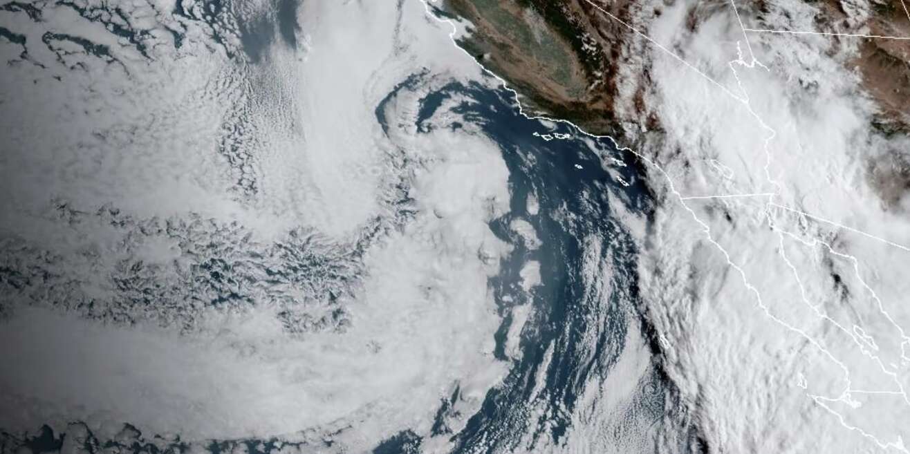
Hurricane Hilary, currently a Category 1 storm, is barreling toward Southern California and is expected to make landfall on Saturday night. The National Hurricane Center has issued a tropical storm watch for most of southwestern California, from the San Diego deserts to San Bernardino County mountains and on to Catalina Island.
This is the first time ever that such a watch has been issued for Southern California. According to the forecast track, Hurricane Hilary will move close to the west-central coast of the Baja California Peninsula before moving across southern California on Sunday afternoon.
The storm will then continue on its path north, passing the Nevada state border on Monday morning. With sustained winds over 39 mph, San Diego, Los Angeles, Las Vegas, Bakersfield, and Tonopah could experience flash floods over the next three days. The hurricane is expected to bring a year's worth of rain to California, Nevada, and Arizona.
While Arizona may not be directly hit, Pima and Yuma County have been warned of heavy precipitation. Tucson, Phoenix, and most of Northern Arizona are expected to experience a normal monsoon day. The Southwest, including Las Vegas, San Diego, and Palm Springs, may also face flooding. Los Angeles is under a flood watch until 5 p.m. on Monday and could receive up to 2 ½ inches of rain.
After hitting Los Angeles and Las Vegas, Hurricane Hilary will continue to move into the Pacific Northwest before dissipating completely. The storm has already made landfall on the Baja California Peninsula in Mexico, causing heavy rain and dangerous flooding. One person has died in Mexico due to the storm.
This storm has resulted in the rescheduling of several events in the Los Angeles area, including a Major League Soccer match and several Major League Baseball games. The potential for tornadoes has also been forecasted for southeast California, western Arizona, southern Nevada, and far southwest Utah.
Hilary is expected to weaken as it moves along the west coast of the Baja California peninsula. However, it will still bring significant rainfall to portions of Southern California and Southern Nevada. The Weather Prediction Center has warned that some arid regions in Nevada could see one to two years' worth of rain in a single day. Residents in Southern California are taking precautions by preparing sandbags and filling generators.
The San Bernardino Sheriff's Office has already ordered evacuations in several communities, and Orange County has urged people in certain areas to evacuate as well. The National Hurricane Center has also warned of the potential for mudslides, landslides, and debris flows in the affected areas. In Mexico, flooding and mudslides have already caused road closures and severe damage to infrastructure.
The Mexican army has mobilized troops in preparation for the aftermath of the storm. Strong gusts of wind and high waves have been recorded off the coast of Baja California and in the Gulf of California. The Eastern Pacific hurricane season has been particularly active this summer, with storms tracking towards Hawaii.
However, it is exceedingly rare for a tropical storm to make landfall in California. Scientists attribute the increasing power of hurricanes and their ability to produce more rainfall to climate change. They have also observed that storms have been slowing down over the past few decades, leading to higher rainfall totals in specific areas.
As Hurricane Hilary continues its path towards Southern California, residents and officials are bracing for the potential impact and taking necessary precautions to ensure their safety.


